Part two of two. Part one got us across the border from Argentina and into Puerto Natales with a trek to start.
The second half of these three weeks was the half we had actually planned the trip around: five days and about 100 kilometres through Torres del Paine, and then, once our legs had recovered, the flight from one end of Chile to the other — from the wettest, windiest mountains in the Americas to the driest desert in the world, in a single day.
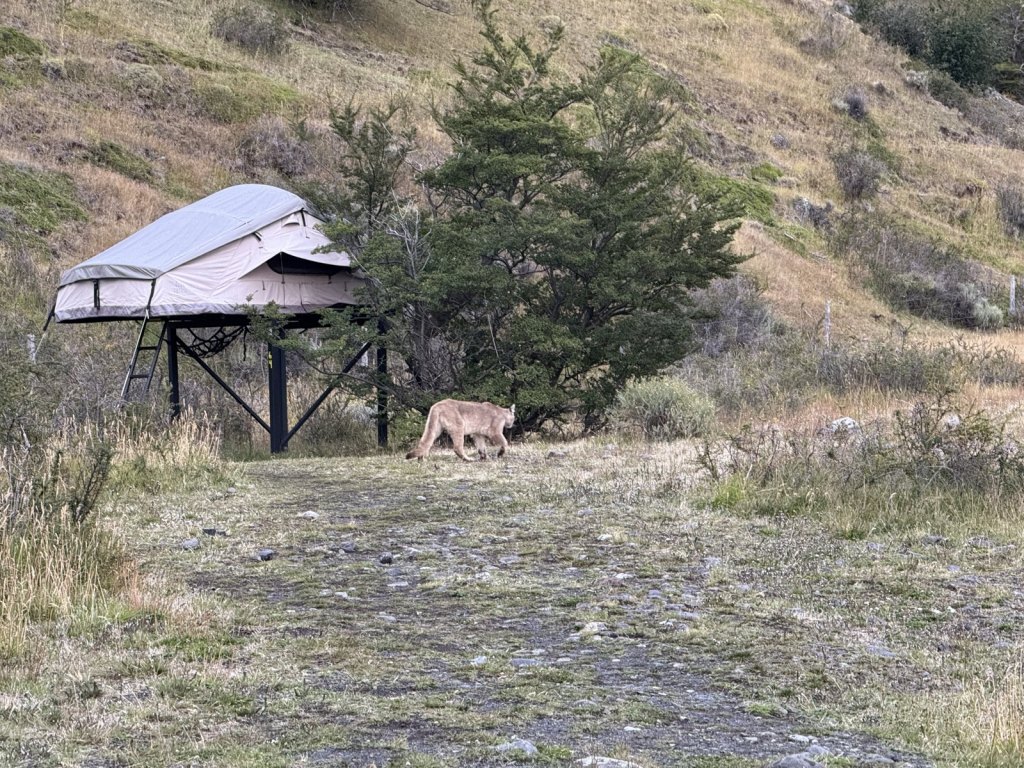
On the first day, before we had properly started, we saw a puma.
And I turned thirty on the day we started.
The route
| Stop | Nights | Getting there |
|---|---|---|
| Puerto Natales | 1 | Bus from El Calafate, about 5h 30m with the border |
| Torres del Paine — the W | 4 (5 days hiking) | Bus into the park, catamaran out |
| Puerto Natales | 1 | Back out of the park by bus |
| San Pedro de Atacama | 4 | A full day of flying, changing in Santiago, then road from Calama |
| Home | — | Flight from Santiago to Munich |
Puerto Natales: the day before
Puerto Natales is a small, wind-blown, corrugated-iron town on a fjord, and it exists in its current form almost entirely because of the national park two hours up the road. Every second shop rents boots and sells gas canisters.
We gave it a day before the trek and it turned out to be an essential one, not a spare one. That day is for: collecting park permits and repacking food and renting whatever you did not bring that the hostels and rental shops run. Then an early night, because the bus into the park leaves at an unkind hour.
The W: five days, 100 kilometres
The W trek is named for the shape it draws on the map — a long traverse along the base of the Paine massif, with three valleys running north off it like the three strokes of a W. The standard quoted distance is around 80 kilometres. Our watches said 100 km over the five days, which is what you get when you walk the full length of every arm and add the approach and exit walks on top.
We hiked it east to west: the towers first, then the French valley, then Grey, finishing with the catamaran across Lago Pehoé. Five days of hiking, four nights in the park. Doing it in this direction means the hardest single climb comes on day one while your legs are fresh and the food in your pack is heaviest — and it means you end on a boat rather than on a hill.
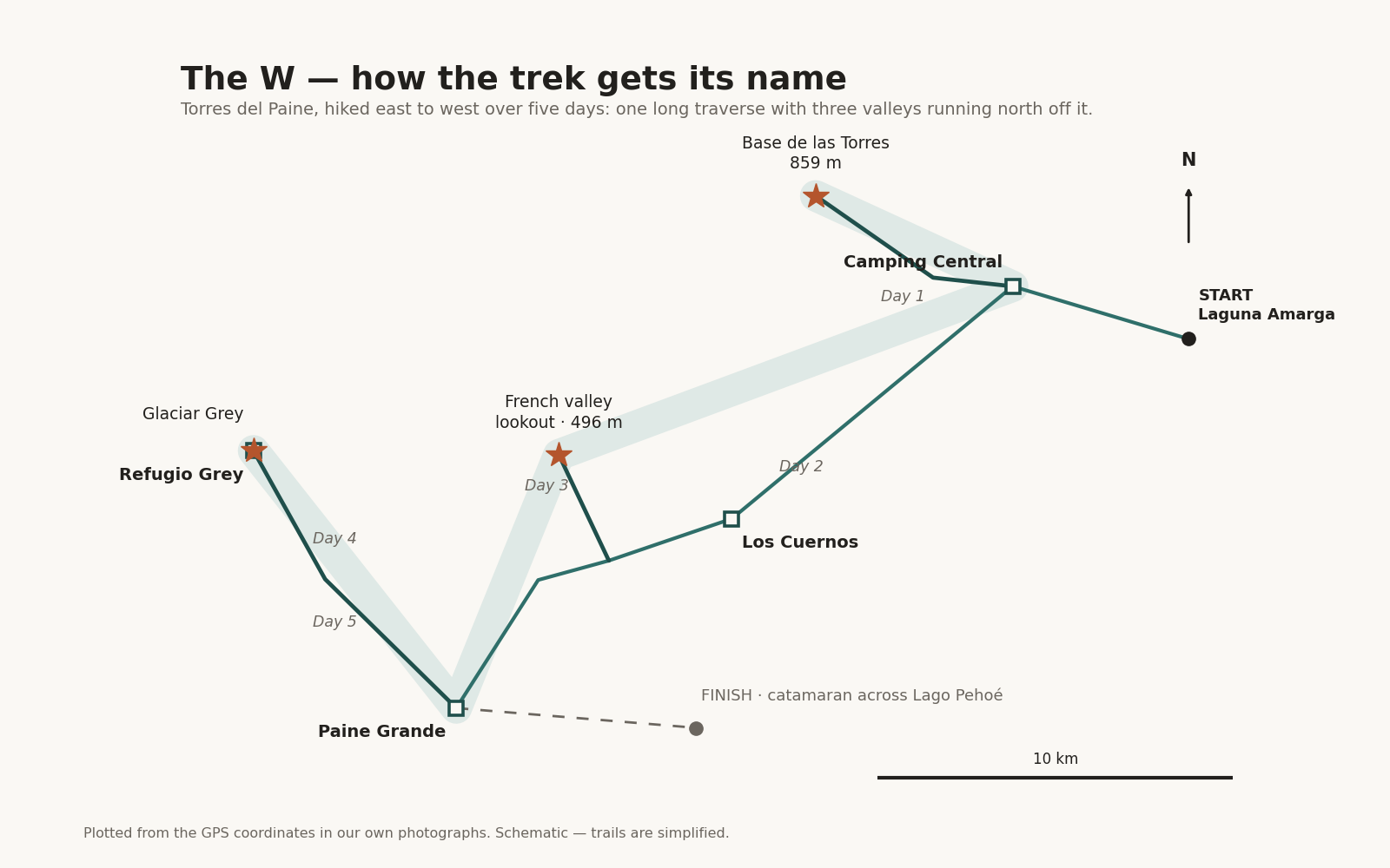
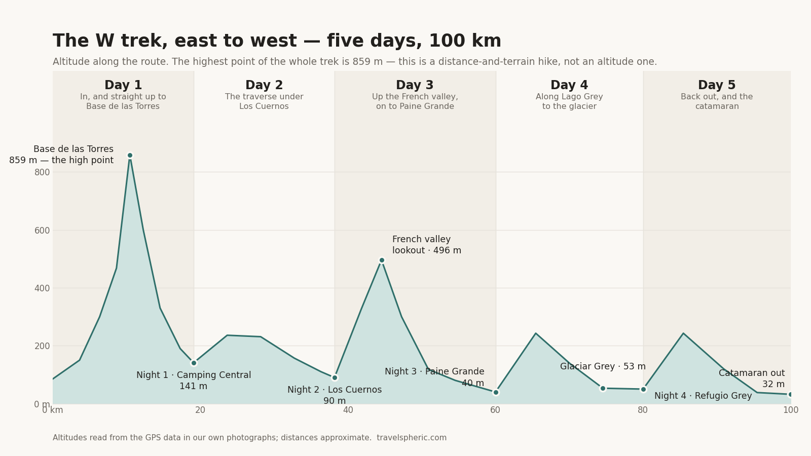
That is the map. Here is the same week seen side-on, which is the more useful picture of what it actually asks of you:
Day one: straight up to Base de las Torres
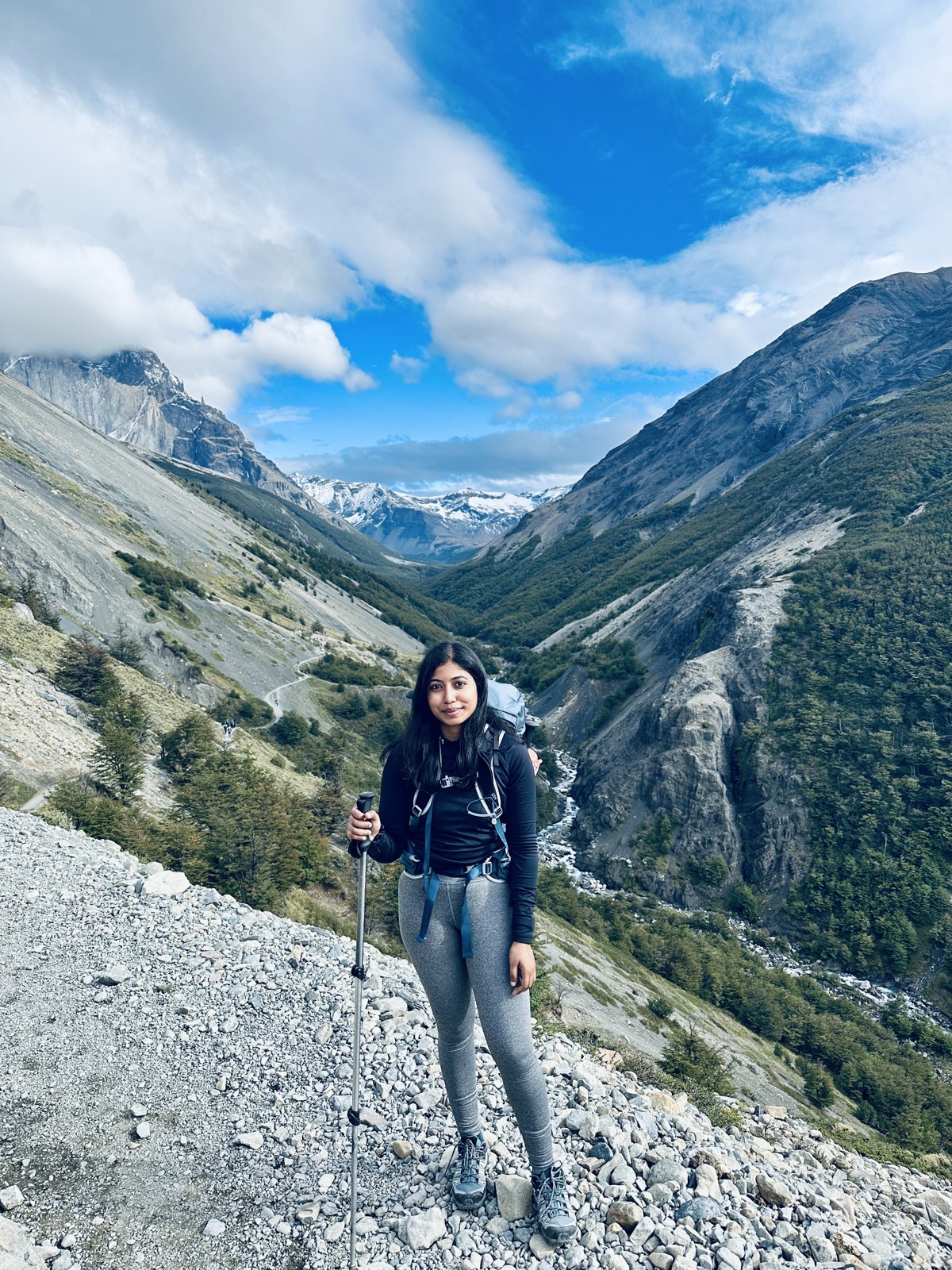
You do not ease into this. The bus drops you at the eastern entrance and the first day is the climb up the Ascencio valley and on to the towers — a long, steady haul with a final section over a boulder field that has no real path, just painted markers and other people’s route-finding, and which goes on considerably longer than it looks.
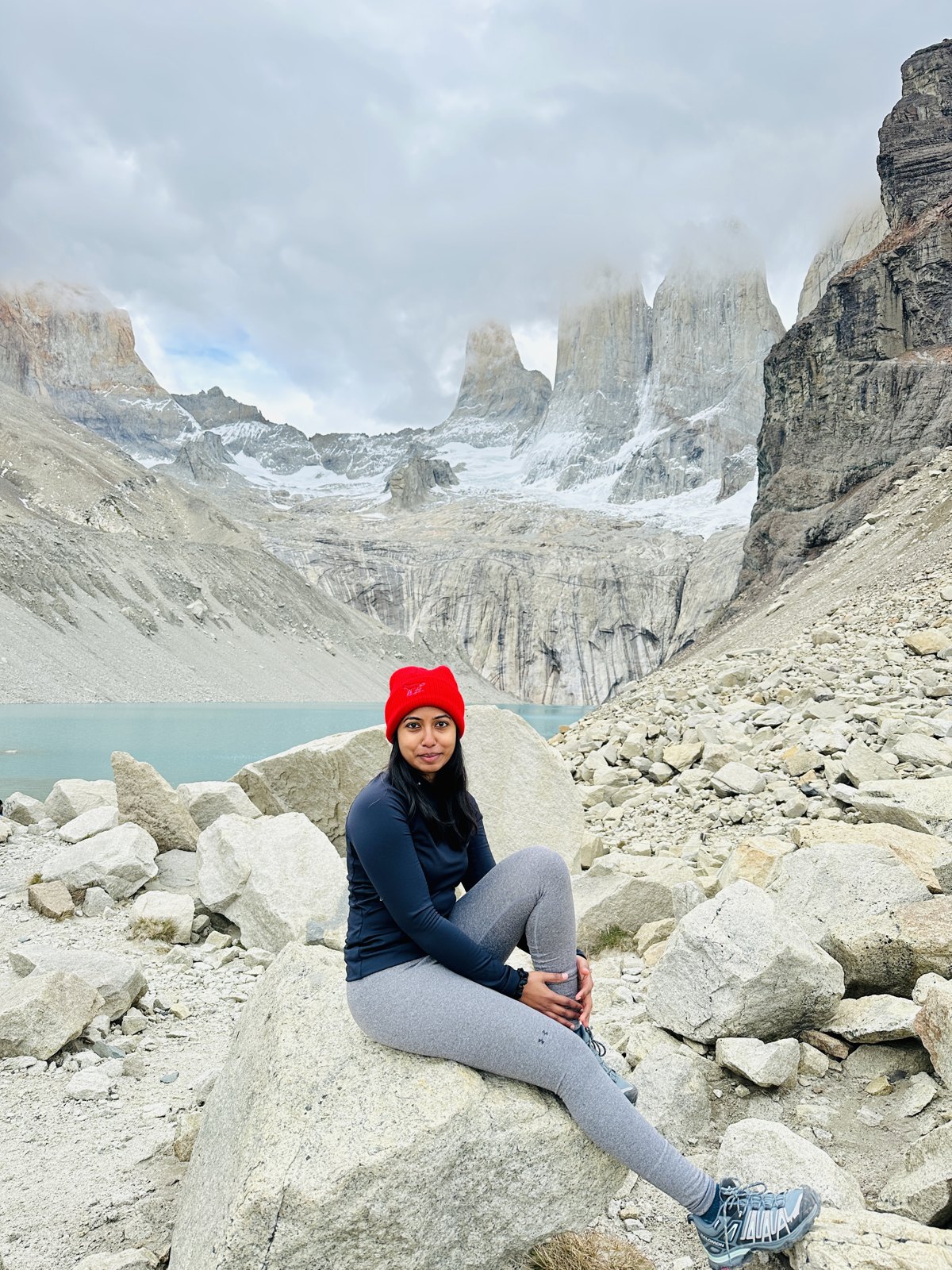
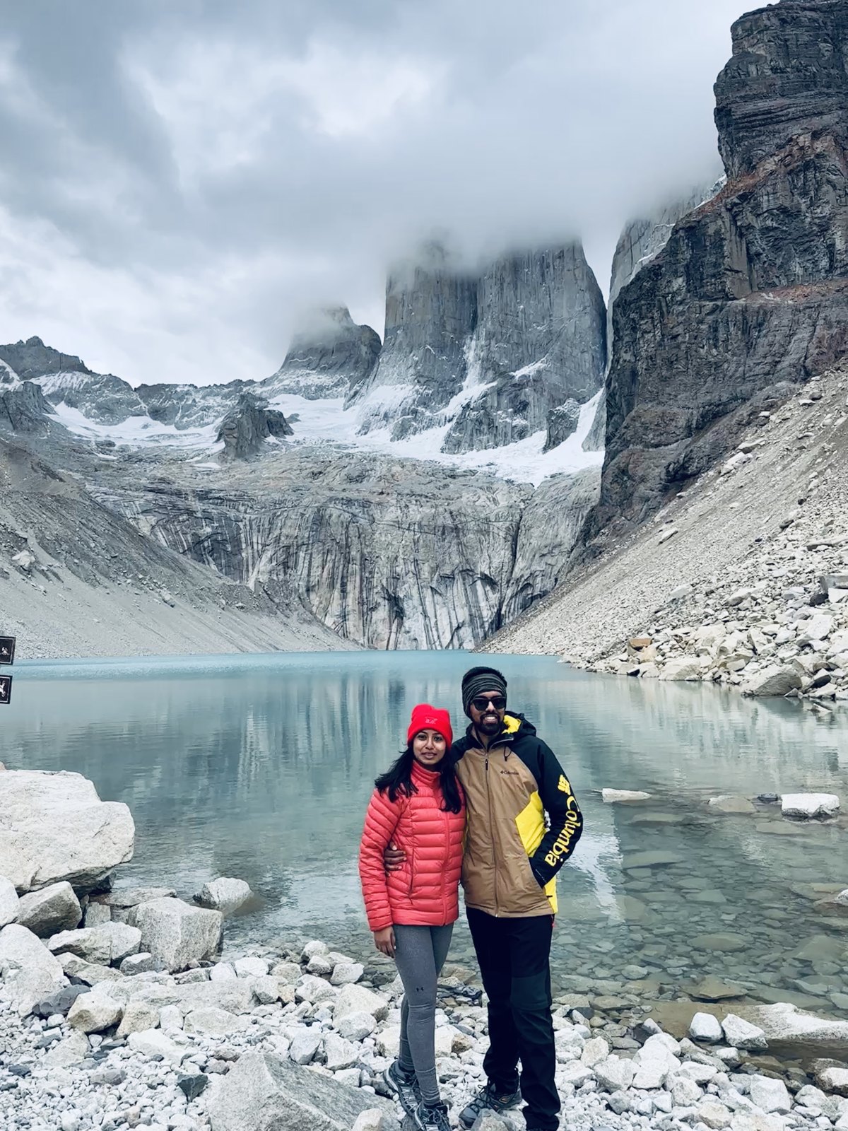
Then it opens out, and there they are: three granite towers standing over a milky green lake, which is the image on the front of every book ever written about Patagonia.
And then, at camp, a puma
We saw a puma. On the first day, walking past the tents in the last of the light, close enough that there was no question about what it was.
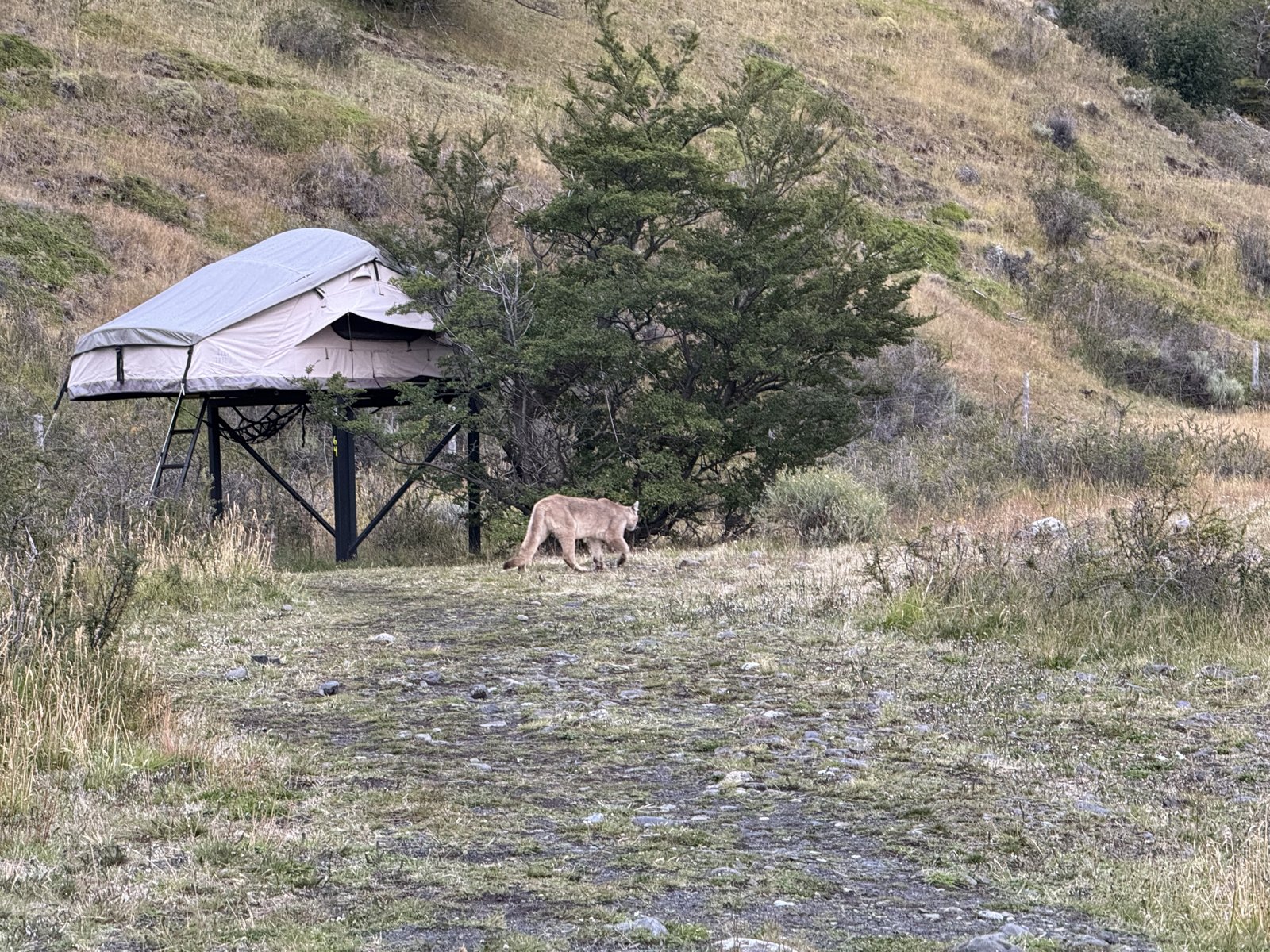
Torres del Paine has one of the densest puma populations anywhere in the Americas — this is genuinely where wildlife film crews come to find them — but most people who hike the W never see one, and we had not remotely expected to. It is the kind of thing you register properly about ten seconds after it has happened.
It also, it must be said, coloured the first night somewhat. We got into the tent knowing there was a large cat somewhere out there in the dark, and the plan we arrived at was: go to the toilet block last thing, both of us, and then do not come out again until it is light. Which we stuck to. Pumas here are not considered a danger to people on the trails and there is no real reason to be frightened — try telling that to two people in a tent at one in the morning.
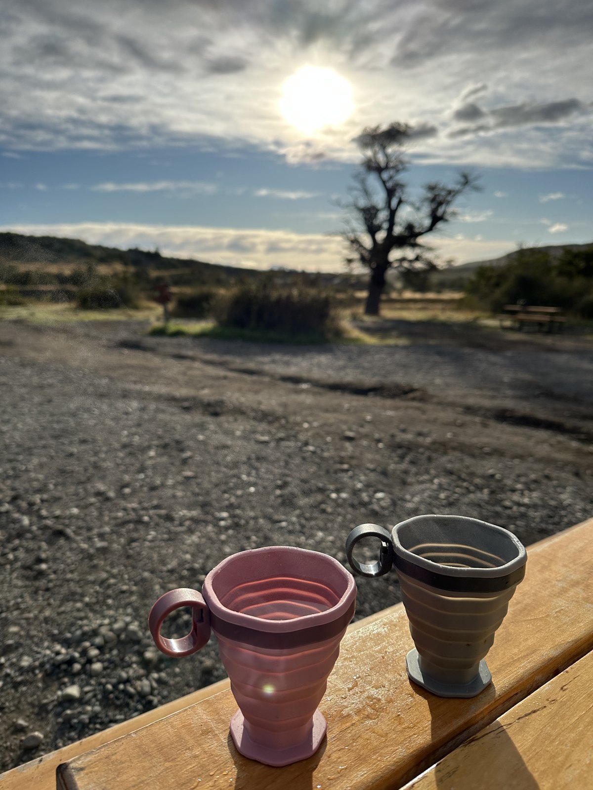
That was day one: a bus, 800 metres of ascent, the towers, a puma and very little sleep. It was also my thirtieth birthday, which I will come back to.
Day two: the long traverse to Los Cuernos
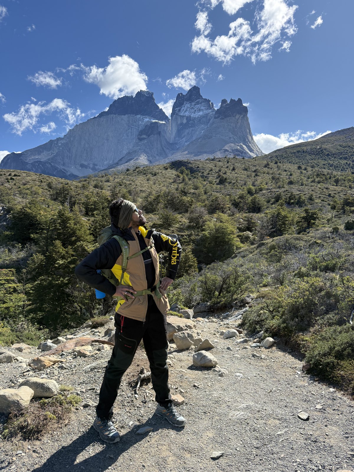
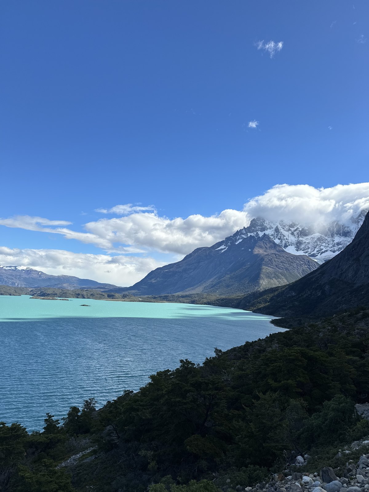
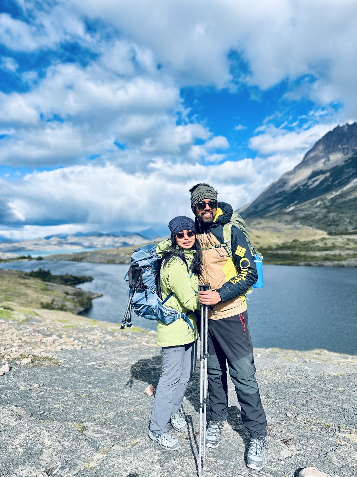
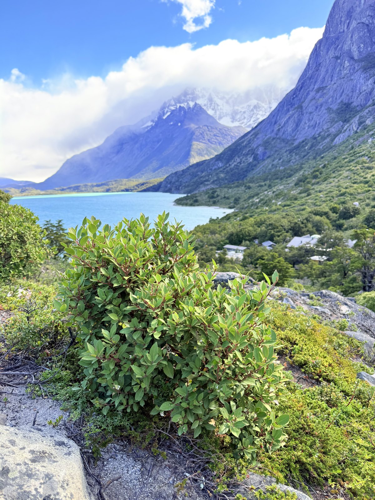
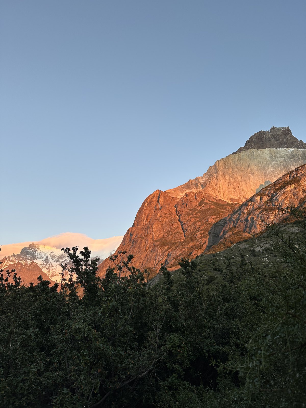
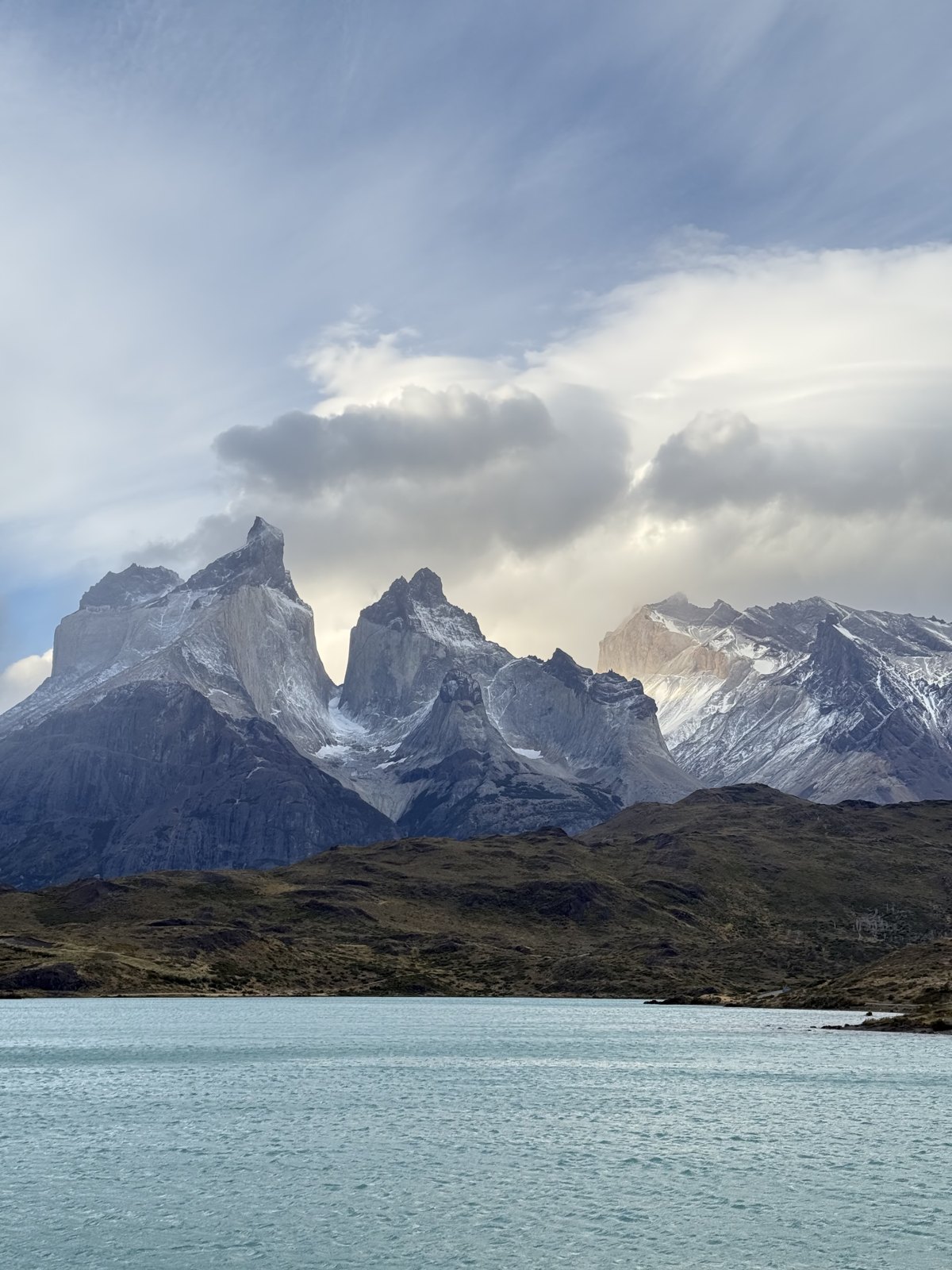
The second day is the connecting stroke of the W — a long, undramatic-sounding traverse west along the north shore of Lago Nordenskjöld, which turns out to be one of the loveliest days of hiking either of us has done. The lake is a colour that photographs as a mistake. Above you, the whole time, are Los Cuernos — the horns — which are dark slate caps sitting on pale granite, and which are, honestly, more striking than the towers.
The night sky, which nobody mentions
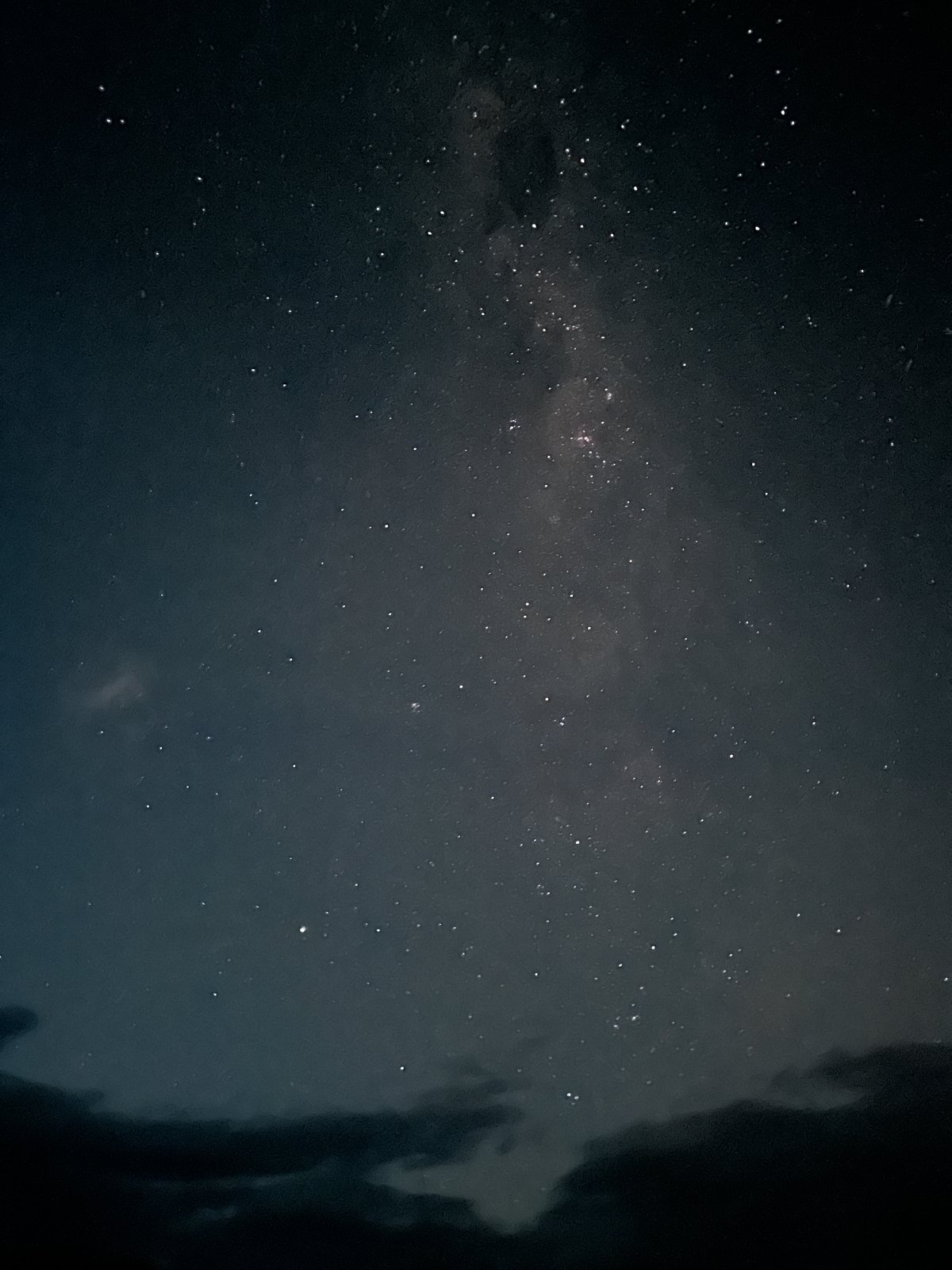
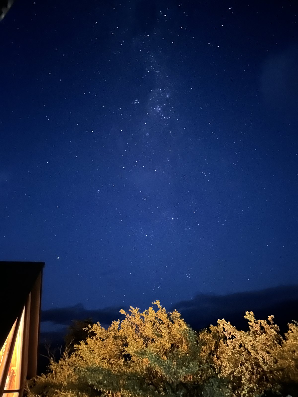
Everyone tells you about the wind and the towers. Nobody told us about the stars.
There is essentially no light pollution in the park and, if the cloud clears at the right moment, you get up in the small hours to a sky with the Milky Way straight overhead and the Magellanic Clouds — our galaxy’s two small companion galaxies, visible only from down here — sitting in it as smudges you can see with the naked eye.
Day three: the French valley
The middle stroke of the W, and our favourite day of the five.
From Los Cuernos you carry on west and then leave the big packs at the Italiano crossing, take a day bag, and climb up into the Valle del Francés. Almost immediately there is a hanging glacier on the west wall — Glaciar del Francés — and it calves while you are watching it: a crack like artillery, then a white plume coming down the rock face. It does this every few minutes, all day, forever.
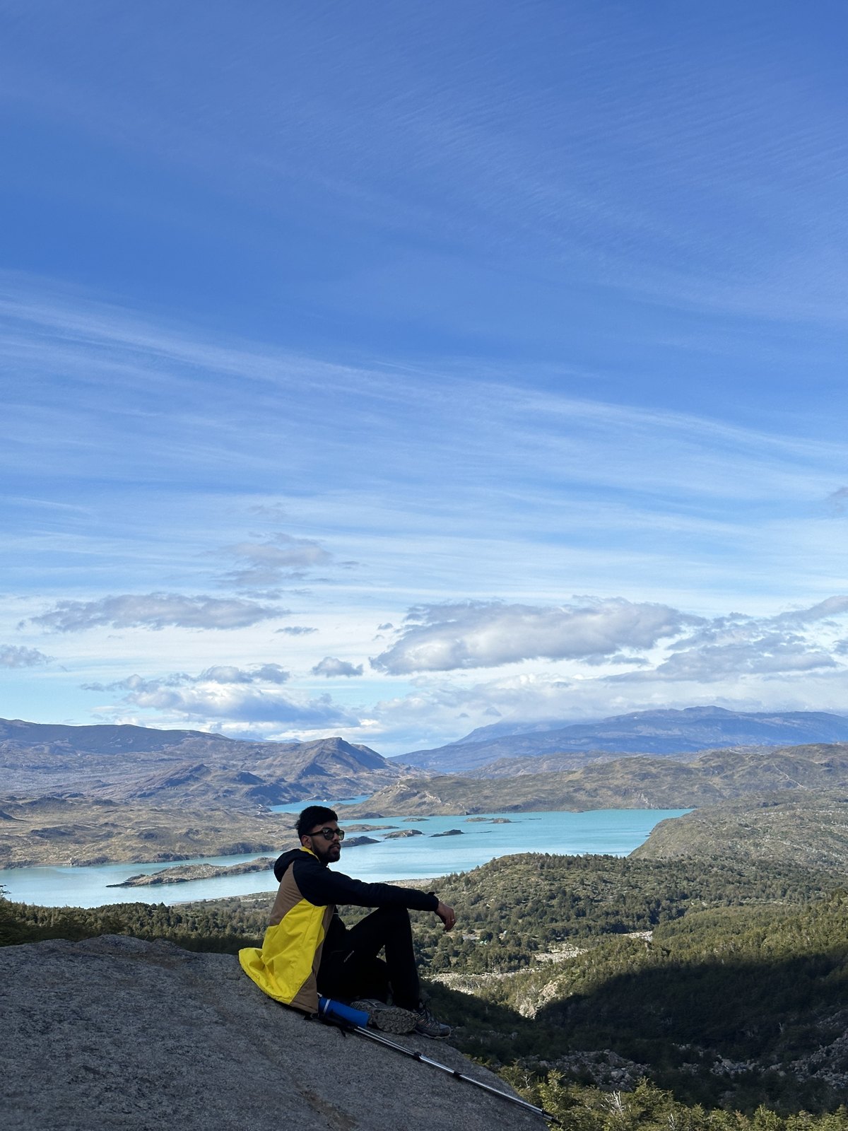
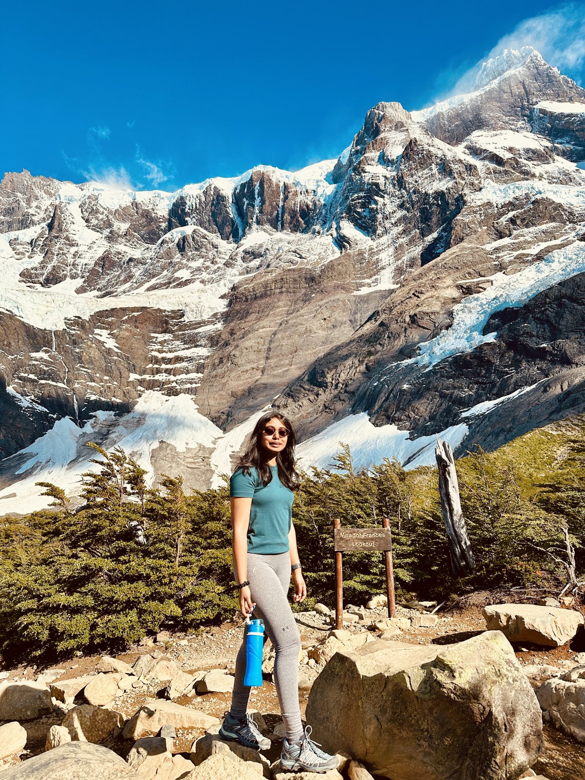
Most people turn round at the Mirador Francés, the lookout partway up where the whole valley opens out behind you — our own GPS puts that at just under 500 metres. Above it, another couple of hours of climbing, is the Mirador Británico, where the valley closes into a full circle of granite around you. If you have the daylight, go all the way up. Start early enough that you do — this is where the extra kilometres on our week came from, and it is the one thing on the W we would go back for.
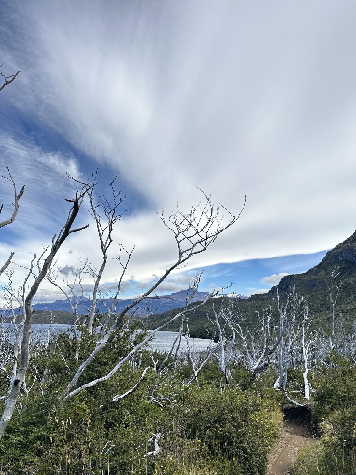
Day four: Paine Grande to Refugio Grey
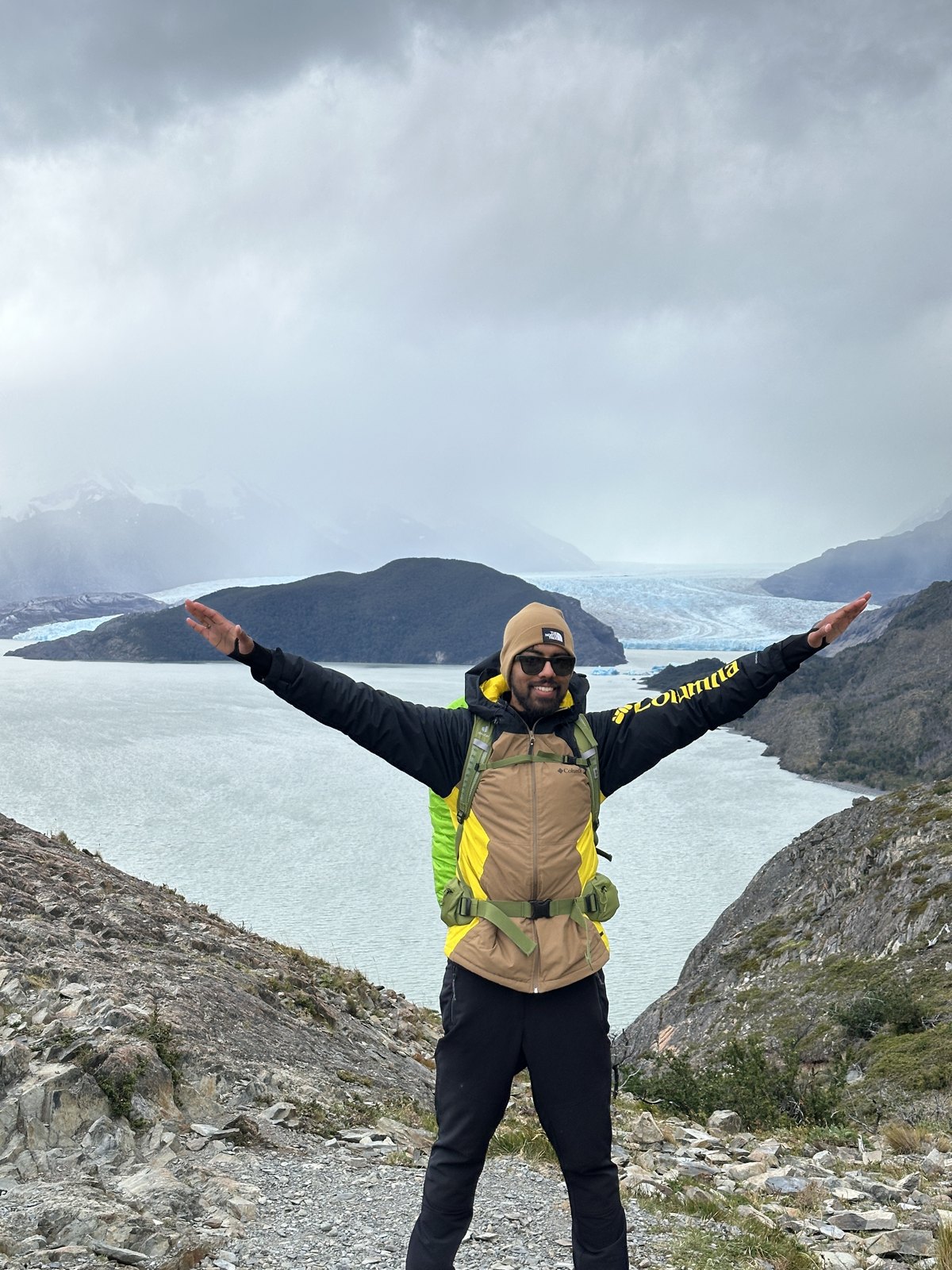
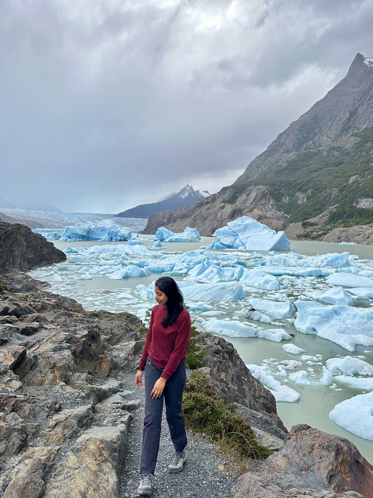
The western arm. You hike along Lago Grey with icebergs in the water — genuinely blue, genuinely enormous, drifting slowly down the lake — until you reach the glacier itself, which is not really a glacier so much as the leading edge of the Southern Patagonian Ice Field, the third largest body of ice on the planet after Antarctica and Greenland.
Day five: out
The last day is a long, flat, tired hike from Refugio Grey back along the lake to Paine Grande, and then onto the catamaran across Lago Pehoé, which is a genuinely great way to finish: you sit down for the first time in five days, and the entire massif you have just hiked around slides past on the right.
What the hiking is actually like
Nobody’s photographs prepare you for the wind. It is not weather in the ordinary sense, it is a physical force, and there are exposed sections where you brace, wait, and then move in the gap. It is a large part of why the place feels the way it does.
The other thing: the weather changes about every forty minutes, in every direction, all day. We had sun, hail, flat grey cloud and blue sky in a single afternoon more than once. You stop taking the waterproof off. March helped us here — late summer, the summer crowds thinning, everything still open and running.
How hard is it, honestly?
First, the language. We keep calling it a trek and people keep hearing a nice long walk. It is not a walk. It is hiking — five consecutive days of six to nine hours on rough ground, carrying what you need on your back, with a hard climb at both ends of most days and no way to shorten one once you have started it.
Here is the honest shape of it. Nothing on the W is technical. No ropes, no exposure, no scrambling that would frighten you, no navigation problem — the trail is obvious and there are other people on it. What makes it hard is not any single moment; it is accumulation. Twenty-plus kilometres a day, four days in a row, on stone and root and loose scree, with a pack that gets lighter by about one dinner a day. Day one’s climb to the towers is roughly 800 metres of ascent, the last stretch of it up a boulder field where you use your hands. Day three, if you go all the way to Mirador Británico and back, is the longest day of the five. By day four the thing that hurts is not your lungs, it is the soles of your feet and the top of your shoulders, and the only cure is to keep going because the campsite is where the campsite is.
And the wind is part of the difficulty, not the scenery. Walking into a Patagonian gust with a full pack is genuinely hard physical work, and it can turn a comfortable hour into a long one.
Who can do it: anyone who is reasonably fit, who has hiked a full day with a loaded pack before and knows what that does to them, and who has broken in their boots. It is not a mountaineer’s route. It is not a beginner’s first hike either — if the biggest day you have ever done is four hours on a marked path with a day bag, do two or three of those back to back before you commit to five in a row somewhere with no exit.
What actually decides how it goes is boring and unglamorous: the weight of your pack, the state of your feet, and whether you eat and drink enough on the move. We taped hotspots the second we felt them and never got a blister. We saw people limping on day three who had not.
One thing that surprises people: the W is not a high-altitude trek at all. The campsites sit between 40 and 140 metres above sea level — the lakes here are barely above the sea — and the highest point of the entire five days is the moraine at Base de las Torres, which our own photographs put at 859 metres. That is lower than plenty of European day walks. There is no thin air, no acclimatisation, no altitude headache.
Look back at the profile at the top of this section and you can see the real shape of the difficulty: the real shape of the difficulty two big spikes and a lot of flat. You climb roughly 800 metres on day one and come all the way back down to sleep, then do about half of that up the French valley on day three and come back down again — and everything in between is long, low, undulating kilometres beside lakes with a pack on. The W does not wear you out with height. It wears you out with distance, repetition and wind.
Where we slept, and the night the tent moved
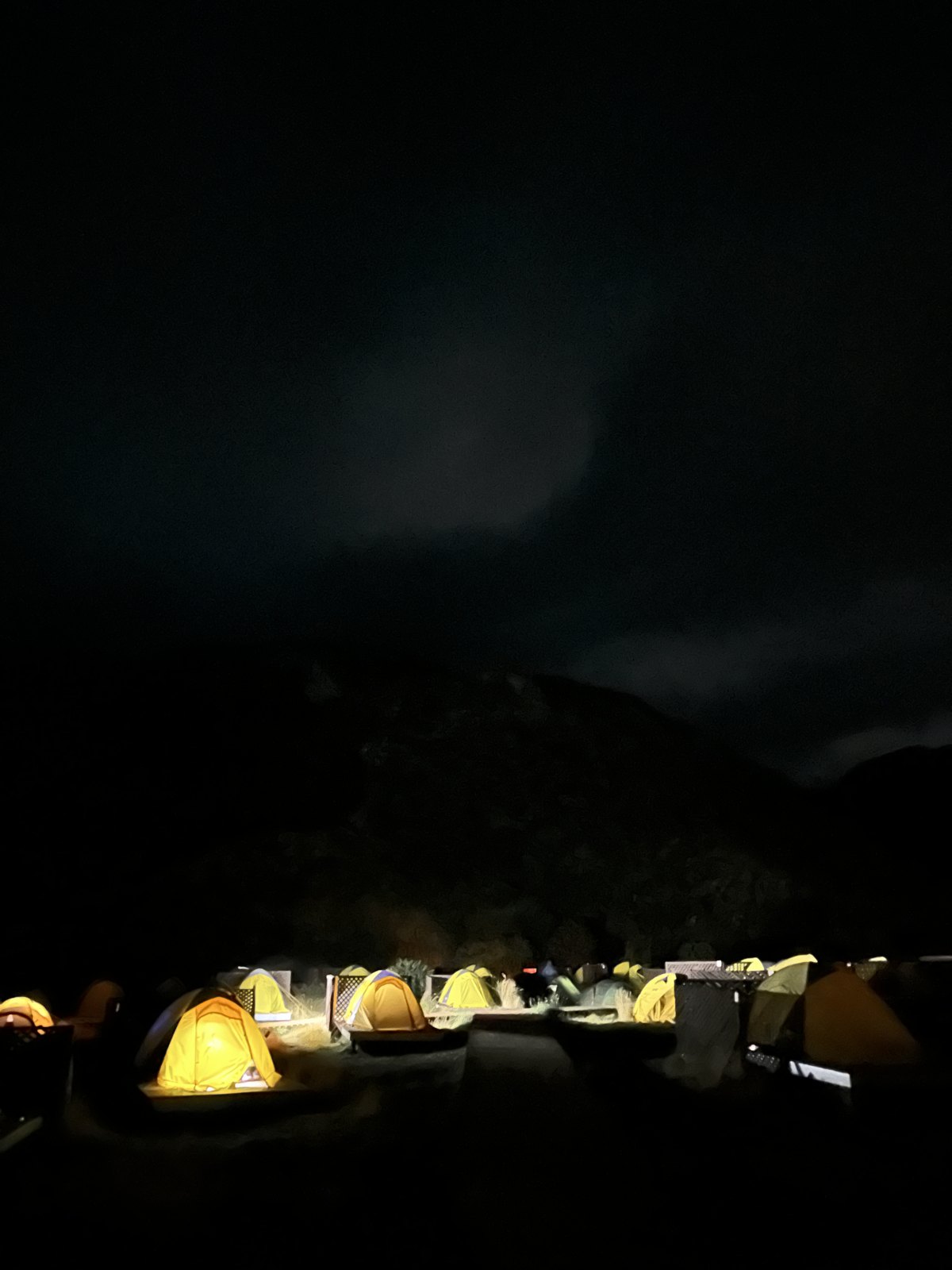
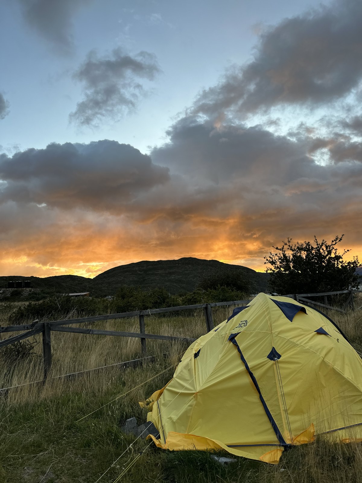
We did the five days on a mix of refugios and camping, and specifically: premium tents for the first two nights — pre-pitched on platforms at Camping Central, the base camp at the eastern end, and then at Los Cuernos. Then the basic yellow tents for the last two, at Paine Grande and Refugio Grey. If you have not seen them, the campsites in the park are rows of identical little yellow domes, and after two nights of being looked after you notice the difference immediately.
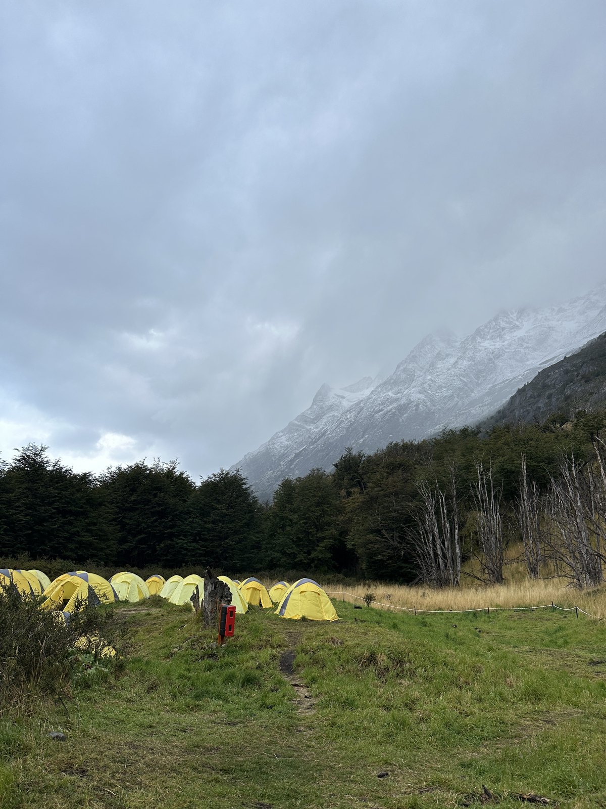
Which is how we ended up having the best night of the whole trip in the worst conditions of it. One of those last nights it rained without stopping and blew all night, and the tent moved — properly moved, fabric snapping, the whole thing straining against the pegs, the noise of Patagonian wind hitting a campsite from the inside. We did not sleep much. It is the single best experience of nature either of us has ever had, and I would not swap it for the premium tent.
The other thing worth saying plainly: planning the W is harder than hiking it. Accommodation inside Torres del Paine is expensive and limited, it is run by two different concessionaires, and where you can get a bed or a tent pitch on a given night decides how far you walk the following day — not the other way round. You are solving a puzzle backwards from availability. Start early, take whatever the popular nights offer you, and build the walking around it.
What it feels like when it is finished
You come round the last corner to Paine Grande on the fifth morning and the thing that hits you is not triumph. It is quiet. Nobody makes a speech. You take the pack off, and your shoulders keep believing it is still there for about ten minutes, and you sit on a wall in the sun with your boots off looking back at a skyline you have walked the whole length of.
That is the part I did not expect. You can see the entire thing at once. From the boat you can point at the notch where the towers are, and the valley where the glacier kept cracking, and the shoulder you came round in the rain on day two, and it is all one continuous piece of ground now — not photographs, not a list of places, but somewhere your own legs joined up. Nothing else does that. You cannot buy that view; there is no road to it. The only way to look at that skyline and feel what we felt looking at it is to have spent five days inside it.
The body reports in afterwards, in order: feet, then shoulders, then a strange hollow tiredness that lasts two days and is not unpleasant at all. You eat like you have never seen food. You sleep eleven hours. For about a week afterwards ordinary things — stairs, a full water bottle, a hot shower — feel like unreasonable luxuries, and I would keep that feeling permanently if there were a way to.
And then the thing that stays. Five days of hiking teaches you, in a way no amount of reading about it does, that you are capable of considerably more than you assume — that the ceiling you carry around in your head is set much lower than your actual ceiling, and that the way to find out is to be somewhere you cannot quit from. There is no taxi at the halfway point of the W. That constraint is a gift. You stop negotiating with yourself and you just walk, and one morning you notice the negotiating has stopped altogether.
I turned thirty on the first morning of it, and I have thought about those five days more than about anything else I have done. It is the proudest I have been of my own legs.
Turning thirty on day one
Small personal aside: my thirtieth birthday was the first day of the trek. Not near it, not the week before — the actual morning we got on the bus into the park. I spent it climbing 800 metres to Base de las Torres with everything I owned for the week on my back, and I finished it in a tent, having been quietly warned there was a puma outside.
I had thought about this a bit beforehand, because thirty is one of those numbers that people make a fuss about, and there was a version of this year where we did the nice dinner and the nice dress and the photographs. I am so glad we did not. I woke up somewhere with no signal, ate something out of a packet, hiked all day, got rained on and then hailed on, and stood at the foot of three granite towers that have been there rather longer than thirty years.
Paritosh had carried something small the whole way in to give me at the end of that day, which I did not know about, which is the entire personality of that man in one sentence.
Anyway — I would recommend it. Not the boots specifically. But if a birthday is meant to mark something, starting the hardest thing you have ever done on the morning of it is a much better marker than a table booking. I spent the four days after my birthday earning it.
The whole five days is still, without any competition, the best decision we have ever made about a holiday and the best thing I have done to date. Not the most comfortable. I have never felt more alive than I did out there.
Back to Puerto Natales, and then very far north
We came out of the park and gave ourselves one more night in Puerto Natales, which was the correct call and we would defend it strongly. Five days of walking and camping ends with a shower, a real bed, a large plate of something, and nothing at all in the diary.
Then the long way north. Chile is over 4,000 kilometres from end to end and we crossed most of it in a day, changing in Santiago, landing at Calama and driving the last hour into San Pedro de Atacama. You leave a place of ice and wind in the morning and arrive somewhere with almost no water in it by evening, and the whiplash of that is one of the best things about doing these two halves in one trip.
San Pedro de Atacama: four days at altitude
San Pedro is a small adobe town of dusty single-storey streets, at about 2,400 metres, with volcanoes on the horizon in every direction. Like El Calafate it lives on excursions; unlike El Calafate it has a genuine character of its own, low and brown and quiet, and it is a pleasant place simply to sit in.
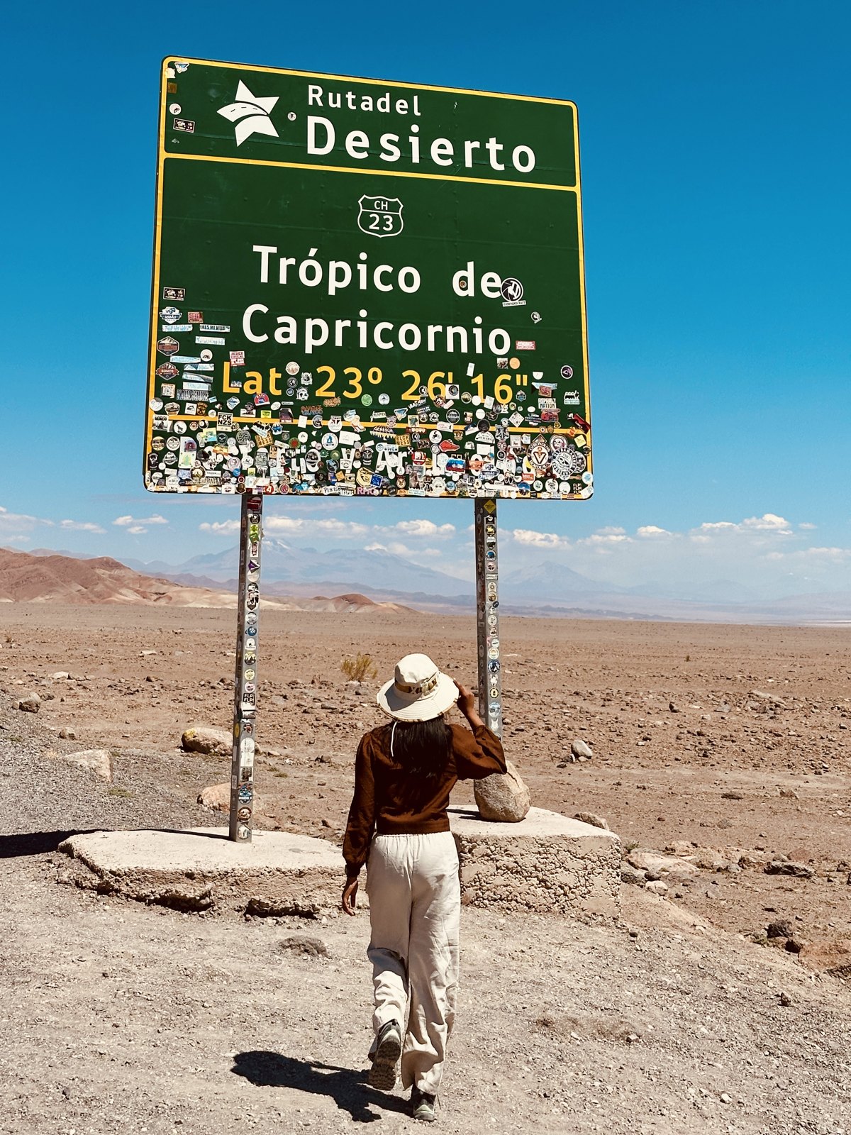
Two things to know immediately. The altitude is real — the town is high and the excursions go much higher, so give yourself the first day flat. And the sun is unlike anywhere else: the driest desert on the planet, thin air, no cloud. Hat, high factor, repeat.
The altiplano: lagoons, Piedras Rojas and a lot of height
The big day, and a long one. You climb out of San Pedro onto the altiplano and spend the day between roughly 3,500 and 4,500 metres, which you will feel in your legs on the shortest walk from the vehicle.
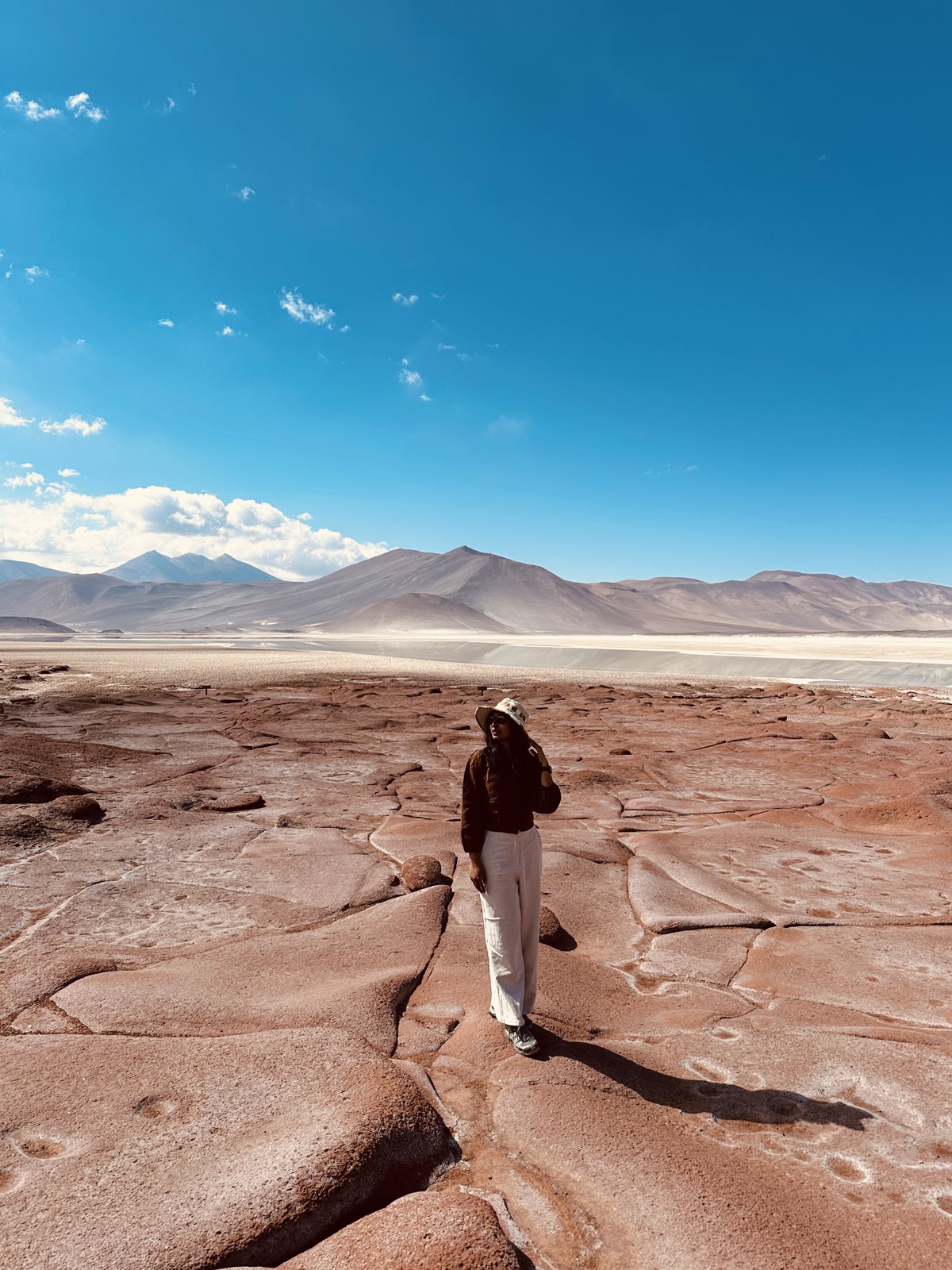
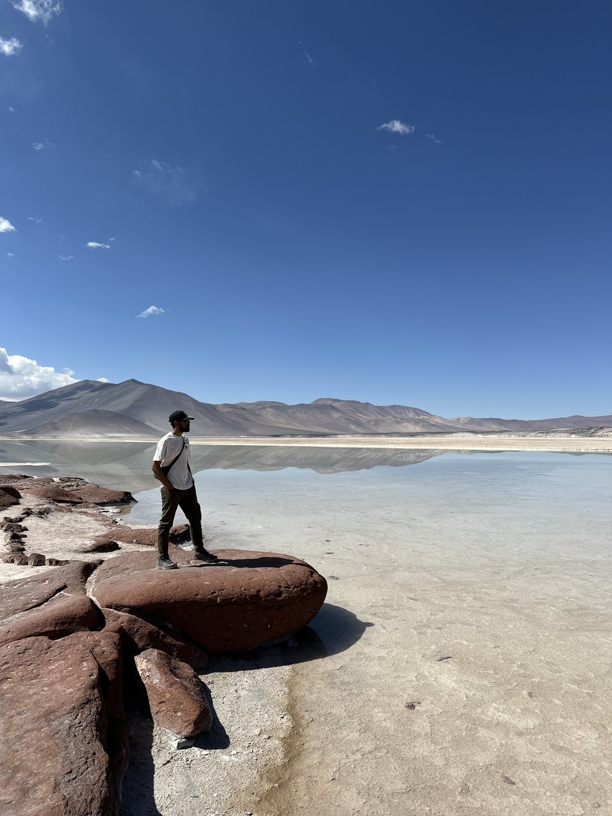
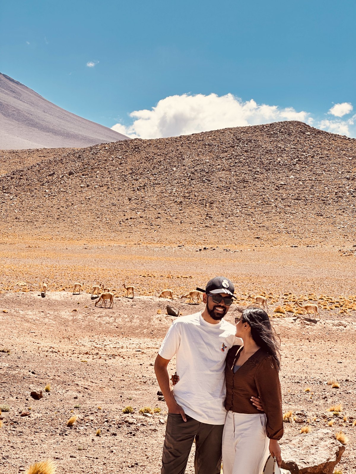
The route also takes in the lagunas Miscanti and Miñiques, two deep blue lakes in a bowl of high desert under the volcanoes, with a colour that seems mathematically impossible in a landscape with that little rain.
It is a lot of driving for a lot of stops. Take the water they tell you to take, take a warm layer — it is properly cold up there even at midday — and do not do this on your first day in town.
Valle de la Luna
Just outside town, and rightly the classic. A landscape of salt-crusted ridges, dunes and eroded rock that genuinely does not read as Earth — the salt crystallises white on red rock, and in the heat it ticks and cracks audibly as it expands.
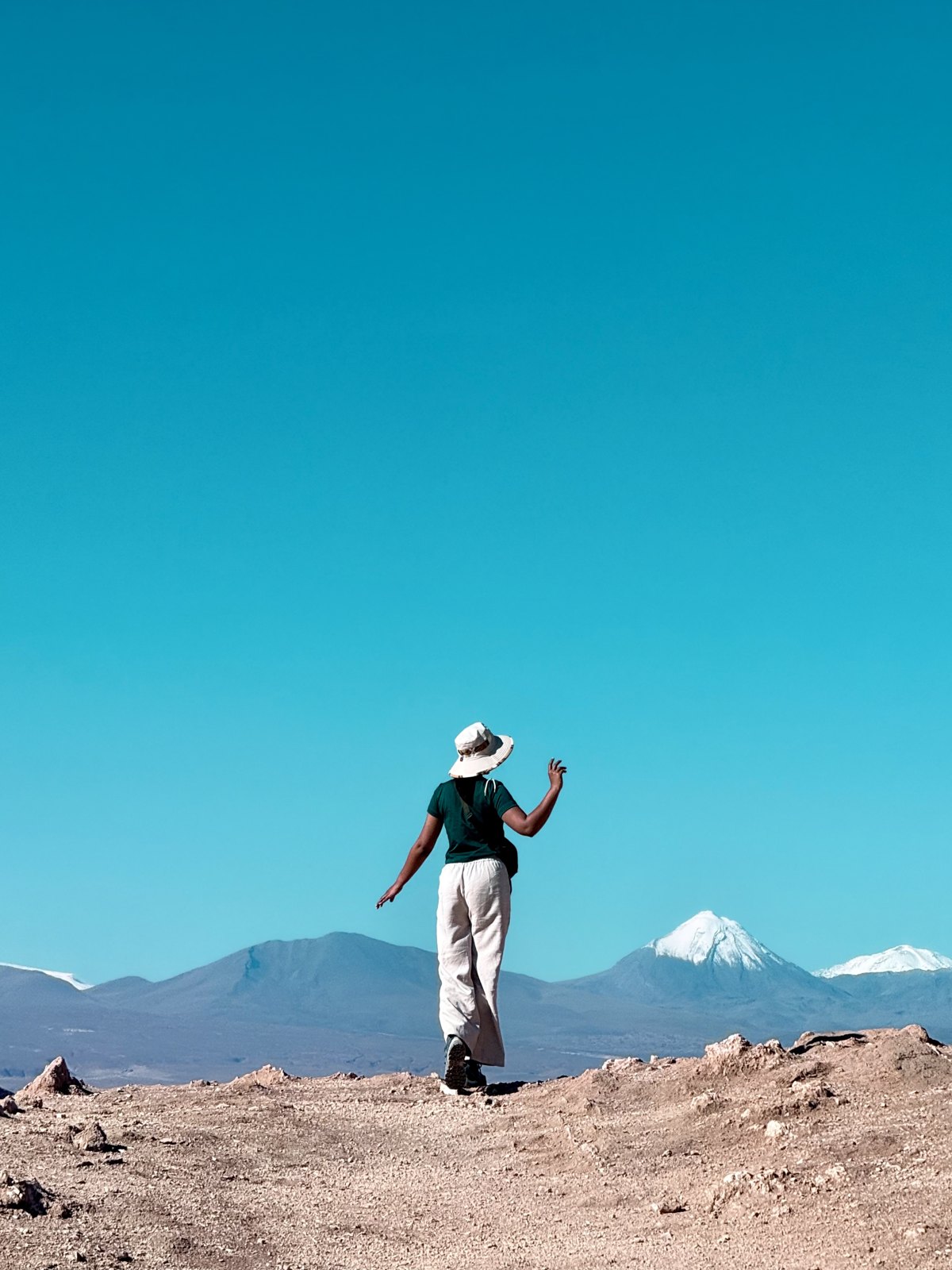
Go for the late afternoon into sunset. The whole valley turns through orange into deep red and then violet as the sun drops behind the Cordillera de la Sal, and the moon usually comes up over the Licancabur volcano while it is happening. It is the most reliably spectacular hour in the region and everybody knows it, so you will not be alone. Go anyway.
The salt flat and the flamingos
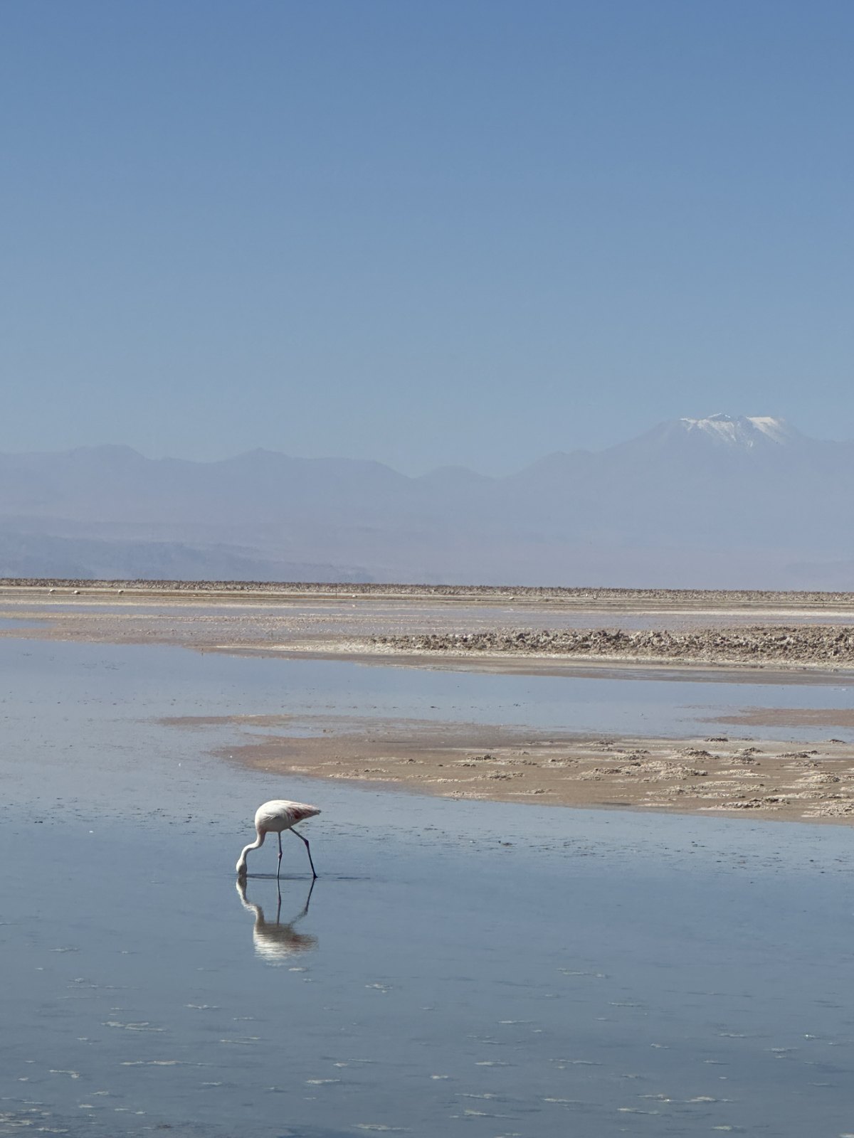
The Salar de Atacama is the third largest salt flat in the world and it does not look like the smooth white mirror people expect — most of it is a crust of jagged grey-white salt that has been pushed up into ridges, sharp enough to shred a shoe, with shallow lagoons lying in it.
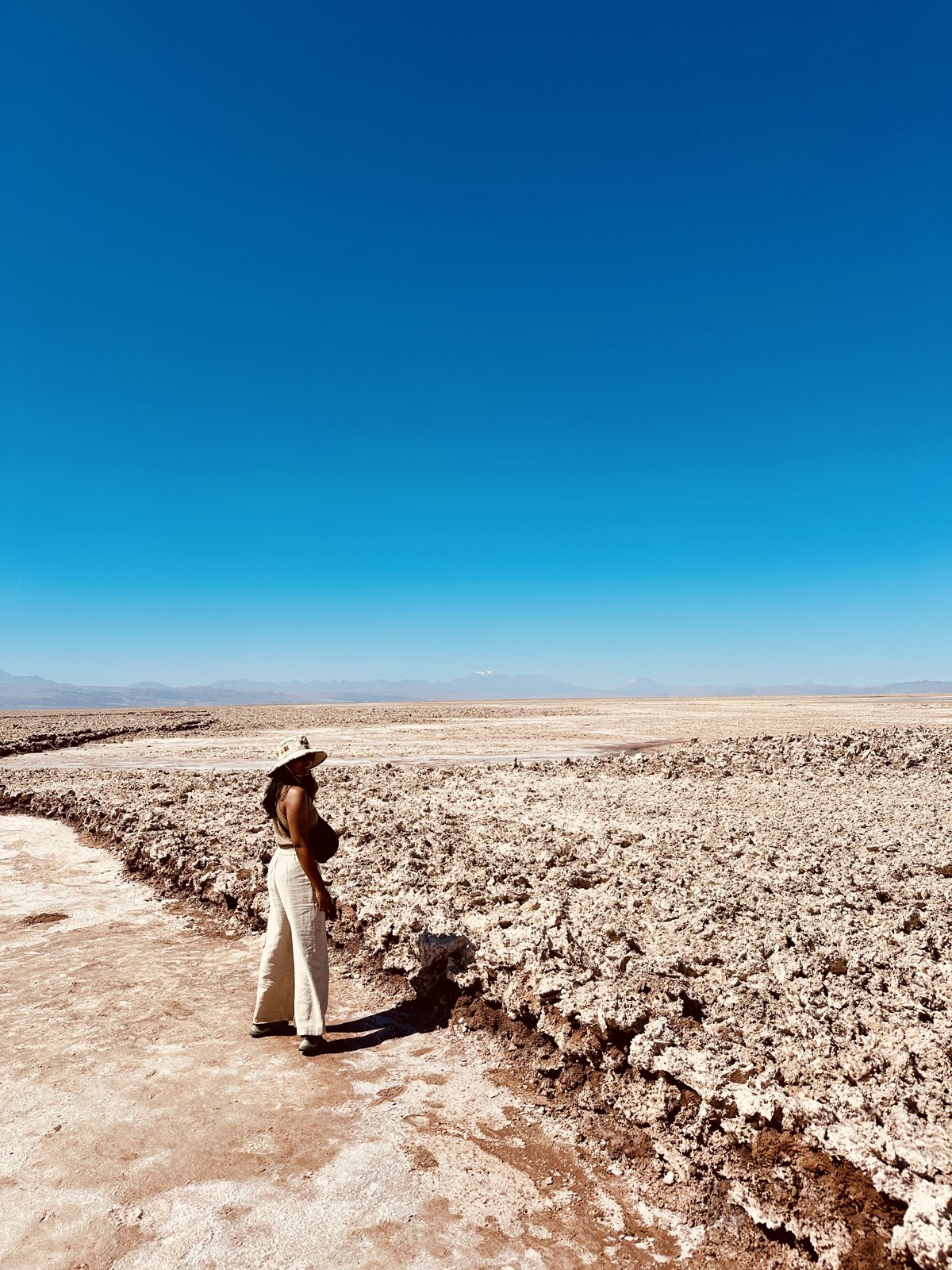
In those lagoons, at Laguna Chaxa, are flamingos: three species of them, feeding in water so mineral it is barely water, with the volcanoes standing behind. It is very quiet out there. That is most of the point.
The rest of it
We had four days and used the rest of them slowly: the town, the food, an enormous amount of sitting outside. After the trek, that was the whole point. The Atacama has one more thing it does better than almost anywhere on earth, which is the night sky — it is where the world’s serious observatories live, for good reason. Even without a tour, walking away from the lights of San Pedro and looking up is a thing that takes a while to get over. We had already had a version of it from a tent in Patagonia, and it turns out you do not get tired of it.
Then Santiago, and the long flight back to Munich, and three weeks in Argentina and Chile were over.
What we would do differently
We would keep the shape of this exactly. Patagonia first while the legs are fresh, desert second while they recover, and a rest day bolted onto each end of the trek. That structure was right.
We would start the French valley earlier and get all the way to Mirador Británico. We were watching the light on the way back down as it was. The middle stroke of the W is the best of it and we left the top of it undone.
One more day in San Pedro, for the sky and the geysers. We did the days and we did not do a proper night — no El Tatio at sunrise, no stargazing tour. Both are on the list if we go back, and we would go back.
And we should have gone to Bolivia. This one still annoys us. San Pedro is a few hours from the Bolivian border and the Uyuni salt flats, and there are three-day crossings that run from the town — the altiplano, the lagoons, the salt flat itself — finishing in Uyuni. It simply never occurred to us while we were planning, and we only worked out it was on the table once we were home. If you are already going as far as San Pedro, look at it before you book your flight out.
And we would still say yes to the mixed refugio-and-tent booking. It is the arrangement that makes the W affordable without making it miserable.
Where the money goes
Torres del Paine is the expensive part of Chilean Patagonia and there is no way around it. Park entry must be bought in advance. Beds in the refugios are priced like a European hotel because every single thing in them arrived by boat or on somebody’s back, and meals inside the park are the same. Camping is much cheaper but the campsites are still booked and paid for, and gear rental adds up.
Book it early — this is the real constraint, not the money. Refugio and campsite reservations for the season open months ahead and the popular nights are gone almost immediately. The park will not let you walk the W without confirmed bookings for every night. The trek is not something you can decide on in Puerto Natales the week before.
Puerto Natales itself is reasonable, and it is where to buy your trail food rather than in the park.
San Pedro is cheaper to be in and expensive to leave. The town is affordable — rooms, food, beer. The excursions are where the budget goes, and the full altiplano day is the priciest of them. It is also the one worth paying for.
The internal flights are unavoidable. Chile is very long. There is no clever alternative.
Practical summary
Book Torres del Paine months ahead. Park entry online, plus every night’s accommodation confirmed before you arrive. This is the single most important sentence in this post.
Go to a free trek briefing in Puerto Natales the day before. Map, weather, huts, rules. It is an hour and it is worth a day of guesswork.
Walk the W east to west. Hardest climb on day one, and you finish on the catamaran instead of on a hill.
Mix refugios and camping. Best balance of cost, weight and morale.
Train for consecutive days, not for distance. One big day proves nothing. Do two or three long hikes back to back with a loaded pack before you go, and break the boots in properly — the W is hard by accumulation, not by any single climb.
Pack for wind first, cold second, rain third — and expect all three in one afternoon. Waterproof shell, proper layers, something that stays on your head in a gale.
Start the French valley early. The lower lookout is wonderful; Mirador Británico is another couple of hours above it and needs daylight you have to plan for.
Take a rest day either side of the trek. One in Puerto Natales before, one after. Neither is a wasted day.
Set an alarm for the middle of one clear night. The sky in the park is worth losing an hour of sleep for.
In San Pedro, acclimatise before the altiplano. The lagoons day tops 4,000 metres and it will find you out otherwise.
Sun protection in the Atacama is not optional. Highest UV on the planet, and it does not feel hot enough to warn you.
March is a very good month for all of this. The far south has thinned out but has not shut down, and the desert is mild.
Three weeks, two countries, four flights to get there and a national airport strike to start it off. If you are planning something like this: put the trek in the middle, book the park before you book anything else, and give yourself one spare day at the very front, because you may well need it.


Leave a Reply